Monday 27 July 2015

Field Work Update - July 27


After a bit of bad weather on July 16 and 17, we hit the ground running on July 18th, ready with repaired and working equipment. Since then, we've had a good seven day streak of long, productive days in the field. Over the weekend now (July 25 and 26), we had two days in a row where the morning was nice, but where we were soaked by rain by early afternoon. We've taken today off, letting the equipment dry off, and we and hope to work Tuesday to Friday again to make up for these weather delays. Here are some nice photos from the collection of what has happened in the last days. 

Calista rolling up seismic cables
These cables can be heavy

An interesting fact I've learned about this mountain: it's a fairly popular area for Holywood studios to shoot movies. There are scenes from the movie Inception that were shot here, and Leonardo diCaprio was back again this spring filming this new movie. On the one hand, it's quite cool to see famous films and actos romping about the same woods as I am. Yet, I think now that I watch those movies, I'll be forever disillusioned because I'll always be thinking about my research site rather than getting engrossed in the movie. 
Finally, I have an interesting story from the field to share. Last Monday, we had a short, but intense shower in the morning, so I had to rush and get my rain pants on in a hurry. In the commotion, however, the safety clip on the can of bear spray in my pocket must have come loose. About an hour later, I smell something peppery and feel a bit of heat on my right thigh. That burning sensation slowly crescendoed, and in a few minutes, I was searing in pain. I tried to tough through it, but had to swallow my dignity, strip down to my undies, and rinse of the affected area with cold water. It put a dent in my day, but at least I can safely say that this was the first time I've ever done field work without pants on. 

Minus that glitch, things are moving along well, and looking forward to getting the last of our data. 

Not carrying heavy stuff, but still hard at work

Even these dry boulders are teeming with life
flowers by the cliff side

The new crew starting Monday, July 20th stayed with us until Friday


A very long radar line

A view of the lake, facing north from the main talus, just below the waterfall


Facing south, looking at the patch of snow below this waterfall
Yay! Our instruments aren't broken anymore, and we're getting data. This was a massive, 572 m long ERT line that around three days to complete.

All the lines we've done so far. For the last days, we'll move to the north side of the lake. 

Friday 17 July 2015

Photo of a true geophysicist

Maybe four computers is getting excessive...

Day 5 - July 17

It was a rainy day, so I spent most of the morning working with the data, creating backups, and doing a little bit of processing. I even had a chance to go for a run after hours of looking at bumps and squiggles. I think the field crew was relieved to have a bit of down time before what looks like two or three long days ahead of us. (The weather forecast is much better after today).

Matthew Lennon, Calista Yim, and I did a quick trip up to site, and we arrived just as the rain was clearing. We managed to shoot some additional GPR with some different antennae. There was a strange spot we weren't able to see clearly using 50 MHz antennae, but by doing is over again in 100MHz, we get a bit more detail.

The next days will be intense. The resistivity instrument is back from Calgary and appears to be repaired successfully. Looking forward to getting back on track.
Locations where we've run some lines. That long one is over 600m!

Saturday 11 July 2015

July 8 Site Visit

I went up with Dr. Masaki Hayashi on Wednesday July 8th for a final reconaissance visit before we start our big geophysics campaign on Monday, July 13.

We  looked at locations where I proposed to to do geophysics, to make sure those choices we reasonable. In doing so, we stumbled some little streams coming out of the rocky talus slopes just below the cliffs. The groundwater is much shallower that we expected! In fact, in some spots, there are willow trees growing on tiny little springs even though they're practically sitting on gravel.

We did a little stream gauging before going home, and now are basically ready to head out again after the weekend. The air is a bit hazy because of forest fires in the region, so I hope it clears up soon.
Beautiful flower-covered meadows at this time of year.
A view from higher up
We didn't realize there were little streams this high up. 
Measuring the electrical conductivity of water in these streams gives us an idea of how long this water has been underground. 

Even on these rocky slopes, there's apparently enough water for these tress to grow. 

A quick stop at Bonsai Lake on the way down. 

Checking the gauge downstream of the lake. 


Tuesday 7 July 2015

Updates on Fortress Field Work - July 7, 2015

With less than a week to go before a big geophysics field campaign, the pace of work is picking up. Here a few updates about recent work

A Change of Scope 

We've narrowed down the scope a bit of this project. Rather than comparing Fortress Lake and Bonsai Lake, we will be focusing just on the Bonsai Lake Watershed.

We did this for a few reasons. First, Bonsai Lake is quite unique in that it's a high-elevation, first-order watershed that is readily accessible by vehicle. In terms of doing geophysics, it is an excellent opportunity for us to try out new or unusual geophysics data acquisition techniques that haven't been tested in an alpine environment. Second, Bonsai Lake has highly unusual geomorphology that makes it an interesting target. As we saw on June 18th on a site visit, there are weird moraines that overprint one another, and are generally pretty messy. Third, Bonsai Lake is closer to the Fortress Ridge Skiing area, so it is the more likely source of water if the resort decides to start making artificial snow. That makes getting a baseline understanding of groundwater more important. Finally, personally, my I'm very interested in learning more about advanced data processing and data acquisition. If we were to try to do two different sites, there would be less time for us to experiment with new techniques, to fix problems with data acquisition in the field, and our data would be much sparser. Narrowing the scope lets us focus on getting a single, high quality data set with good coverage.
Maps showing the location of Bonsai Lake within the Kananaskis Valley

Recent Field Visits

June 18, 2015

With the weird geology of the area piquing his curiosity, Dr. Gerald Osborne from the University of Calgary joined me for a day trip to the field site. Jerry and I were joined by Hongye Wu and May Guan of the University of Saskatchewan for part of the day. Jerry's expertise in surficial geology in alpine environments was very valuable in decoding this very unusual geological environment..  

First we inspect the north end of the lake, where there are big blocky moraines that stop the flow of water over land, allowing this lake to form. While there is no stream leaving this lake, there is a spring about 100 m away, meaning water from the lake is exiting somehow. Jerry's best guess is that these ridges are recessional moraines. When this area was covered in glaciers, the ice stayed put in one spot so long that rocks falling off of the cliffs nearby fell directly onto the ice and eventually moved along the top of the glacier to be deposited on this moraine. That explains why the moraine is made up of boulders of all kinds of size (up to the size of trucks) and they still have sharp corners.

We also noticed a smaller moraine at a higher elevation that we later climbed too. It's clearly from a more recent period of cold climate, and the shape of rocks indicates that these rocks were actively pushed by the glacier (i.e. it's a terminal moraine). 

Hongye also showed us her instrumentation, and pointed out interesting water features. In the marsh that feeds Bonsai Lake, there are two streams that run through it. One of these, which starts at a big talus cone, runs year round. I wonder why that is...

Bonsai Lake as seen from the Northwest side. Notice the little moraine up in snowy slope in the upper right corner of the photo

From the northern tip of the lake, looking up at the cliffs 
High up on a little moraine below the steep cliffs. Notice the little marsh on this side of the lake that serves as a source of water to Bonsai Lake. Notice also the big blocky ridges on the far side of the lake that block the water from flowing out. 


Jerry talks to Hongye and I about the debris flow features that he sees at the base of the talus
Even though the lake goes dry in the summer, these streams within this marshy little meadow have water in them year-round. Why is that?
There's water seeping out from under this moss at the bottom of this talus cone. There must be water stored somewhere inside this pile of rocks

June 28, 2015 

Ten days later, I returned to Bonsai with Masaki Hayashi and Larry Bentley, both professors at the University of Calgary. Having seen the different geological structures on sight, we wanted to now focus on the hydrology of the area. Based on what we saw at surface, we tried to make guesses about what's happening underground, that is, where and how is water getting into and out of the ground.

There are three main areas that interest us:
  1. The talus cone
  2. The alpine marsh/meadow
  3. The spring downstream of Bonsai Lake
An oblique view, facing south, of Bonsai Lake. Some other key features are noted

The Talus Cone

 As far as we can tell, this big pile of rocks at base (the talus cone) is the main source of water in the area once most of the snow has melted. Hongye told us the stream that comes off of this pile of rocks is the only one that has water flowing in it all year round. Hence, there must be something about it that allows to store water. This will definitely be a spot we want to probe underground to understand what's going on.


The Alpine Meadow/Marsh

 This marshy area is quite unusual. The surface of this valley generally slopes gently downwards, yet this place is flat enough to allow water to slow down, and for fine sediments to settle. Clearly, this muddy area must help store and slowly release water over the summer after all the snow has melted, but how deep exactly is this marsh? Does all the water form this marsh enters the lake via the stream, or does some of it seem through the ground? Again, we need to probe underground to find the answer.


The Outlet Spring

Finally, we inspect the north side of the lake again, and we take a closer look at these springs. Somehow, water is seeping from the lakebed, through this huge moraine on the north side, and exiting into the stream. Is there a big leak somewhere where the water rushes out, or does it seep in gradually all over the place. Again, some to probe underground.

At the spring below Bonsai Lake, where water form the lake presumably is discharged

The moraines on the north edge of the lake form a kind of dam, preventing a outlet stream from forming. 

Upcoming Work 

On July 8th, Masaki and I will be doing some stream gauging, and confirming the location of our geophysics survey lines. Then, our wild 17 consecutive days of field work will begin on Monday, July 13. It's going to be hectic, but enlightening (we hope).

Friday 12 June 2015

An Introduction to Fortress Ridge - Field Work Orientation

Friday, June 12, 2015

Welcome!

If you're reading this, you were likely sent here by me because you expressed interest in helping me do science this summer in Kananaskis. (If not, you're still welcome to read along). This is a brief primer for my research plans and what you can expect this summer.

Alpine Hydrology Research at University of Calgary

Previous Research at Lake O'Hara

At the University of Calgary, our team led by Dr. Masaki Hayashi studies the role of groundwater in alpine watersheds. In recent work at Lake O'Hara, we found that even though there is not a lot of soil or overburden on top of the bedrock, these deposits can still store significant amounts of water. In turn, these help delay water that is released by melting snow in late spring and to sustain river levels later on in the summer. This is very relevant given that areas downstream of mountain basins, like the semi-arid Canadian prairies, rely heavily on surface water from these basins. Plus, with climate change set to alter the timing of snowmelt and precipitation, knowing how groundwater works is important for understanding the effects on populations downstream.

Some example papers:
http://doi.org/10.1002/hyp.8060
http://doi.org/10.1002/hyp.8144
http://doi.org/10.1029/2006GL026611 
http://dx.doi.org/10.1016/j.jhydrol.2014.12.041 

Our New Research Site

The problem is that while we've demonstrated convincingly that groundwater plays a large role at Lake O'Hara, we don't know if it's just a special case, or whether all watersheds in the mountains behave in a similar manner. That is why we are expanding our research to Fortress Ridge, a ski area in Kananaskis Country, Alberta. Fortress Ridge is very different from Lake O'Hara; among other things, it is further inland, its climate is drier, there is more substantial human development, there's no active glacier, and the bedrock is shale and limestone rather than hard quartzite. By understanding the role of groundwater here, we will be better able to generalize how important groundwater is in alpine zones in the Canadian Rockies.


My study looks at two different watersheds: Fortress Lake and Bonsai Lake. Not only are these basins different from Lake O'Hara, they're substantially different from one another in terms of surface cover and geomorphology, making them interesting to compare.


Summer Field Work 2015

Research Goals and Methods

The main goals of my study are to:
  • create inventory of surficial units 
  • map bedrock topography 
  • characterize groundwater storage during late snowmelt 
  • characterize kinetics (conductivity) of sediments 
  • compare the hydrogeology of these watersheds to one another and to previous study sites
  • Test out geophysics data acquisition methods not often used alpine hydrogeology surveys
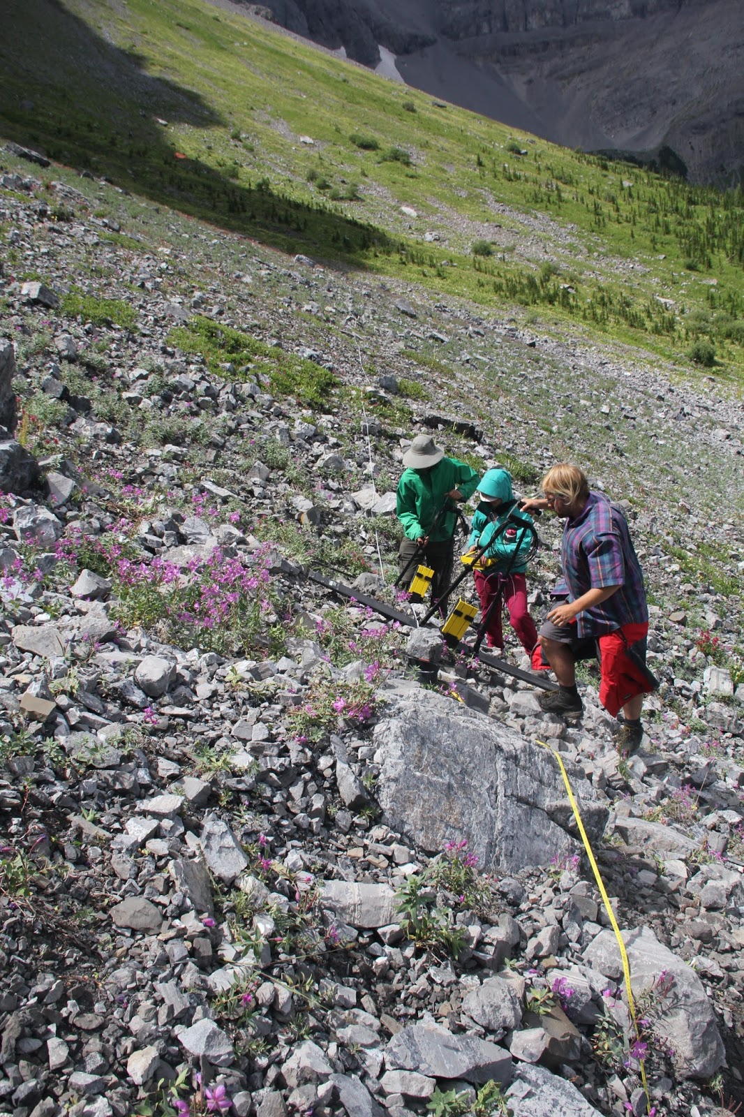
Like in all our alpine research, we will use geophysics to look underground. This is mostly because we cannot drill wells directly because of environmental regulation or difficult access.  I plan to use five different methods:
  1. Electrical resistivity tomography (ERT), which images differences in electrical resistivity
  2. Seismic refraction tomography, which images difference in seismic velocity
  3. Ground penetrating radar (GPR), which images boundaries in electromagnetic wave velocity 
  4. Self-potential, which measures changes in potential due to redox reactions and/or fast-moving water
  5. Passive seismic monitoring, to find underground channels

Your Role

I will mostly need your help with ERT, seismic refraction, and GPR, which are the most labour intensive methods.

Your role while on site may include:
  • Installing survey lines
  • Carrying equipment
  • Recording the coordinates of measurement locations with the differential GPS (DGPS). 
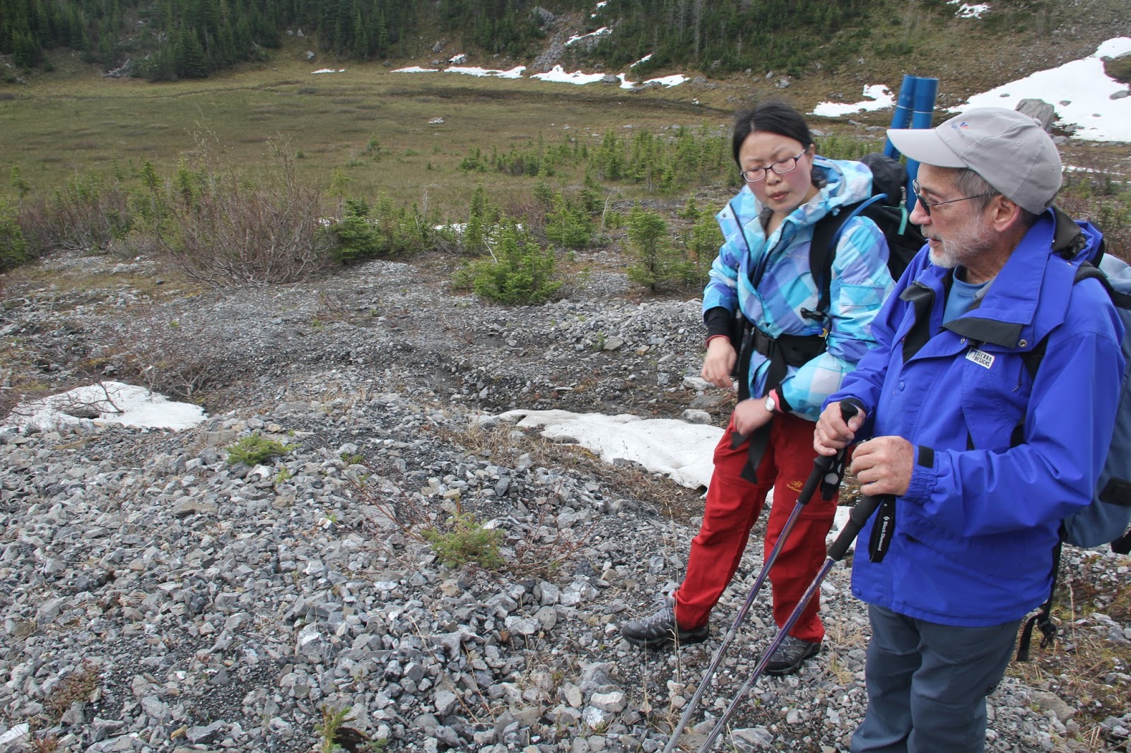
It will be a lot of physical work, though at Bonsai Lake, we are able to drive almost right up to the measurement locations. Fortress Lake will require about 1 km of hiking.

Logistics

Our surveys will begin July 10, and will last 3 to 4 weeks. I will need approximately 4-5 people on GPR survey days, and 6-7 people when doing seismic refraction and ERT.

We have accommodation booked  (two townhouses) at the U of C Biogeoscience station, which is marked on the first map above. It is approximately a 15 minute drive to the field site form there.

Don't be crazy: I don't expect you to be there for 3 weeks straight (unless you really, really ache to be in the mountains that long). I hope to organize 2 to 3 different crews to rotate out together.